Advancing urban flood mitigation and climate resilience: a GIS-based hydrodynamic modeling approach using HEC-RAS and remote sensing data

Downloads
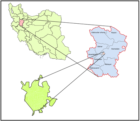
Over the past decades, significant adverse effects, including the resiliency of critical centers, have emerged. The negative impact has manifested in the vulnerability of critical urban centers during natural disasters and emergencies, leading to their inefficiency, heightened public dissatisfaction, and a breakdown in service delivery during crises. In order to enhance the resilience of key centers, it is essential to first identify and assess the vulnerability of these crucial urban hubs to various risks and threats. In this research, the classification was graded and assessed following the formulation of a questionnaire and the collection of results. Utilizing the arithmetic mean of sample opinions, the Analytic Hierarchy Process (AHP) was applied through the Expert Choice software to assign weights to these criteria and sub-criteria. Subsequently, the key urban centers were identified. The hydrology within the city and its surroundings, along with the modeling of rivers during various return periods, were studied using the HEC_RAS. The results were then integrated into GIS to delineate flood risk zones in the city of Hamedan. Following the input of the arithmetic mean of sample opinions into the Expert Choice, the value of each indicator was meticulously determined. This delineation indicates that the quantitative level indicator benefits from the maximum weight, while the economics of assets hold the least weight in the assessment. Ultimately, by aligning key urban centers with flood-prone zones in the GIS framework, vulnerable centers were enumerated. The method used in this study can be extended to all cities based on their river flow modeling and urban zoning.
Kennedy, L., Robbins, G., Scott, D., Sutherland, C., Denis, E., Andrade, J., ... & Bon, B. (2011). The politics of large-scale economic and infrastructure projects in fast-growing cities of the south. Literature review, 3.
Brunn, S.D., J.F. Williams, and D.J. Zeigler, Cities of the world: world regional urban development. 2003: Rowman & Littlefield. ISBN: 978-0847698981
Jebran, K. and S. Chen, Can we learn lessons from the past? COVID‐19 crisis and corporate governance responses. International Journal of Finance & Economics, 2023. 28(1): p. 421-429.
Trenberth, K. E. (2005). The impact of climate change and variability on heavy precipitation, floods, and droughts. Encyclopedia of hydrological sciences, 17, 1-11.
Bhuiyan, S. R. (2014). Flood hazard and vulnerability assessment in a riverine flood prone area a case study. LAP LAMBERT Academic Publishing, ISBN-13 : 978-3659645327
Mustafa, A., et al., Effects of spatial planning on future flood risks in urban environments. Journal of environmental management, 2018. 225: p. 193-204.
Pathan, A.I. and P. Agnihotri, Application of new HEC-RAS version 5 for 1D hydrodynamic flood modeling with special reference through geospatial techniques: a case of River Purna at Navsari, Gujarat, India. Modeling Earth Systems and Environment, 2021. 7: p. 1133-1144.
Pratama, M. I., Rohmat, F. I. W., Farid, M., Adityawan, M. B., Kuntoro, A. A., & Moe, I. R. (2021, April). Flood hydrograph simulation to estimate peak discharge in Ciliwung river basin. In IOP Conference Series: Earth and Environmental Science (Vol. 708, No. 1, p. 012028). IOP Publishing.
Criado, M., et al., Flood risk evaluation in urban spaces: The study case of Tormes River (Salamanca, Spain). International journal of environmental research and public health, 2019. 16(1): p. 5.
Delleur, J. W., Dendrou, S. A., & McPherson, M. B. (1980). Modeling the runoff process in urban areas. Critical Reviews in Environmental Science and Technology, 10(1), 1-64.
Azizi, E., et al., Flood vulnerability analysis using different aggregation frameworks across watersheds of Ardabil province, northwestern Iran. International Journal of Disaster Risk Reduction, 2023. 91: p. 103680.
Solaimani, K. and S. Darvishi, Zoning and Monitoring of Spring 2019 Flood Hazard in Khuzestan Using Landsat-8 Data. Iranian journal of Ecohydrology, 2020. 7(3): p. 647-662.
Ouma, Y.O. and R. Tateishi, Urban flood vulnerability and risk mapping using integrated multi-parametric AHP and GIS: methodological overview and case study assessment. Water, 2014. 6(6): p. 1515-1545.
Bloemen, P., et al., Lessons learned from applying adaptation pathways in flood risk management and challenges for the further development of this approach. Mitigation and adaptation strategies for global change, 2018. 23: p. 1083-1108.
Bennett, J. and R. Blamey, The choice modelling approach to environmental valuation. 2001: Edward Elgar Publishing. ISBN: 978-1840643046.
Albano, R., L. Mancusi, and A. Abbate, Improving flood risk analysis for effectively supporting the implementation of flood risk management plans: The case study of “Serio” Valley. Environmental Science & Policy, 2017. 75: p. 158-172.
Qiu, T., et al., Heterogeneous ad hoc networks: Architectures, advances and challenges. Ad Hoc Networks, 2017. 55: p. 143-152.
Karber, P., The Indochina Chronicles: Travels in Laos, Cambodia and Vietnam. 2007: Marshall Cavendish International Asia Pte Ltd. ISBN: 9789814435413.
Eakin, H., A.M. Lerner, and F. Murtinho, Adaptive capacity in evolving peri-urban spaces: Responses to flood risk in the Upper Lerma River Valley, Mexico. Global Environmental Change, 2010. 20(1): p. 14-22.
Harirchian, E., et al., A review on application of soft computing techniques for the rapid visual safety evaluation and damage classification of existing buildings. Journal of Building Engineering, 2021. 43: p. 102536.
Zehzad, B., Kiabi, B. H., & Madjnoonian, H. (2002). The natural areas and landscape of Iran: an overview. Zoology in the Middle East, 26(1), 7-10.
Heydari, A.H., et al., Effects of Covid-19 disease on electricity consumption of various sectors in Iran. Case Studies in Chemical and Environmental Engineering, 2023: p. 100600.
Ghorbani, M., et al., Evaluating Surface Water Collection Infrastructure for Management of Urban Flood Risk: Integrating HEC-RAS with GIS in Overland Flow Modeling and Flood Hazard Zone Mapping within the Kan River Watershed of Tehran. AGU24.
Stallings, R. A. (2003). Methods of disaster research. Xlibris Corporation. ISBN: 978-1401079703.
Tallis, H., Levin, P. S., Ruckelshaus, M., Lester, S. E., McLeod, K. L., Fluharty, D. L., & Halpern, B. S. (2010). The many faces of ecosystem-based management: making the process work today in real places. Marine Policy, 34(2), 340-348.
Tallis, H., et al., The many faces of ecosystem-based management: making the process work today in real places. Marine Policy, 2010. 34(2): p. 340-348.
Bell, M. L., Zanobetti, A., & Dominici, F. (2013). Evidence on vulnerability and susceptibility to health risks associated with short-term exposure to particulate matter: a systematic review and meta-analysis. American journal of epidemiology, 178(6), 865-876.
Terwee, C.B., et al., Rating the methodological quality in systematic reviews of studies on measurement properties: a scoring system for the COSMIN checklist. Quality of life research, 2012. 21: p. 651-657.
Wen, J., et al., A Computational Tool to Track Sewage Flow Discharge into Rivers Based on Coupled HEC-RAS and DREAM. Water, 2023. 16(1): p. 51.
Gascon, C. (2007). Amphibian conservation action plan: proceedings IUCN/SSC Amphibian Conservation Summit 2005. IUCn.
Saeidi, P., Mardani, A., Mishra, A. R., Cajas, V. E. C., & Carvajal, M. G. (2022). Evaluate sustainable human resource management in the manufacturing companies using an extended Pythagorean fuzzy SWARA-TOPSIS method. Journal of Cleaner Production, 370, 133380.